
Leading 3D Laser Scanning and Survey Services in Perth and Melbourne
At Scan Tech Surveys, we specialize in 3D Point Cloud Surveys in Perth & Melbourne, including contour and feature surveys, as-built architectural floor plans, elevation drawings, structural surveys and more.
In today’s data-driven construction, engineering, and infrastructure sectors, precision and accuracy are everything. At Scantech Surveys, we offer high-definition 3D laser scanning services in Perth and Melbourne, delivering fast, reliable, and highly accurate digital survey data for every kind of project. Whether you're managing a complex industrial facility, undertaking large-scale infrastructure development, or conducting detailed as-built documentation, our advanced scanning solutions provide the clarity and confidence needed for success.
Advanced 3D Laser Scanning in Perth and Melbourne
3D laser scanning has revolutionised how projects are planned, managed, and executed. Using cutting-edge LiDAR technology, we capture millions of data points in seconds, creating detailed digital twins of existing environments. At Scantech Surveys, our 3D laser scanning in Perth and 3D laser scanning in Melbourne allows clients to make informed decisions, reduce on-site time, and eliminate costly rework.
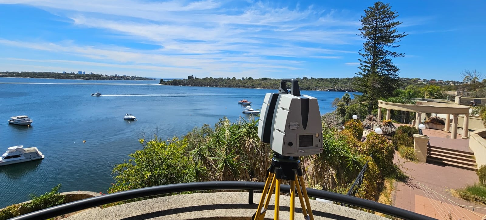
Our experienced technicians use state-of-the-art terrestrial laser scanners to provide millimetre-accurate data of buildings, infrastructure, heritage sites, plants, and terrain. These scans can be used for modelling, clash detection, verification, and ongoing facility management. From planning through to completion, our services provide the solid foundation your project demands.
3D Laser Scanning Services – Complete Data Acquisition Solutions
Our comprehensive 3D laser scanning services are trusted by professionals across multiple industries including architecture, construction, oil & gas, mining, transportation, and heritage preservation. The data we provide can be delivered in various formats such as point clouds, mesh models, and fully textured 3D models, compatible with popular platforms including AutoCAD, Revit, and BIM software.
We offer services for:
- As-built documentation
- Building Information Modelling (BIM)
- Clash detection and verification
- Volume and deformation monitoring
- Structural analysis and facility maintenance
- Heritage conservation
Whether you're scanning a single structure or an entire industrial site, our expert team ensures precision at every stage of the process.
3D Laser Scanning Services Perth – Fast, Accurate, and Local
In Western Australia, our 3D laser scanning services in Perth are renowned for their accuracy, speed, and technical excellence. We serve architects, engineers, contractors, and asset managers throughout the Perth metropolitan area and regional WA, helping them bring their vision to life with reliable data capture.
Our Perth-based technicians are familiar with the unique demands of local projects, whether it’s mining operations, commercial builds, or infrastructure upgrades. Our mobile scanning teams are available for rapid deployment, ensuring minimal downtime and maximum efficiency.
3D Laser Scanning Services Melbourne – Cutting-Edge Scanning in Victoria
For clients in Victoria, Scantech Surveys provides 3D laser scanning services in Melbourne that meet the most stringent industry standards. From detailed urban construction projects to heritage conservation and transport infrastructure, we deliver unmatched detail and accuracy.
Our Melbourne team uses the latest LiDAR and photogrammetry technologies to deliver comprehensive point cloud data and 3D models for design, analysis, and construction workflows. We also provide post-processing and modelling services, delivering ready-to-use data that integrates seamlessly with your CAD or BIM environment.
3D Point Cloud Surveys – Precision Data for Complex Projects
3D point cloud surveys provide the raw data necessary to build a complete, digital representation of any physical space. By capturing millions of XYZ coordinates, our point clouds allow engineers and designers to visualise structures in three dimensions, analyse spatial relationships, and extract critical measurements with pinpoint precision.
Our 3D point cloud surveys in Perth and 3D point cloud surveys in Melbourne are ideal for:
- Infrastructure condition assessments
- Structural retrofits and extensions
- Heritage restoration and documentation
- MEP coordination and facility upgrades
We generate high-resolution point clouds in various formats, giving clients complete control over how they use and manage spatial data throughout the lifecycle of their projects.
3D LiDAR Surveys – Advanced Terrain and Surface Mapping
3D LiDAR surveys are a key tool in delivering large-scale, high-resolution topographic and surface data. Using light detection and ranging (LiDAR) technology, we collect vast amounts of spatial data quickly and safely, even in challenging or hazardous environments.
Whether you need a digital elevation model (DEM), contour map, or detailed surface analysis, our LiDAR solutions provide precise results at high speed. Ideal for construction, environmental monitoring, road planning, and mining operations, our 3D LiDAR surveys ensure accuracy, safety, and scalability.
Drone Mapping and Surveying Perth – Aerial Intelligence from Above
In addition to terrestrial laser scanning, Scantech Surveys offers drone mapping and surveying in Perth using UAVs equipped with high-resolution cameras and LiDAR sensors. This airborne approach allows us to capture detailed orthomosaics, terrain models, and 3D site overviews with exceptional speed and accuracy.
Our drone surveys are ideal for large or inaccessible sites, reducing the need for scaffolding or manual access while increasing safety and coverage. We serve industries such as:
- Mining and quarrying
- Construction and civil works
- Agriculture and environmental monitoring
- Urban planning and land development
With licensed drone pilots and powerful post-processing tools, we turn aerial data into actionable insights for planning, design, and execution.
Why Choose Scantech Surveys for 3D Laser Scanning Services
At Scantech Surveys, we bring together the latest technology, proven expertise, and a commitment to accuracy that sets us apart. Our services are fully tailored to the unique demands of each client, and we work closely with project stakeholders to ensure that the data we provide meets every technical and operational requirement.
Clients choose us for:
- State-of-the-art equipment and software
- Fast turnaround and responsive support
- Highly experienced survey professionals
- Detailed reporting and data accuracy
- Full integration with CAD and BIM workflows
We are trusted by some of Australia’s leading developers, engineers, and government bodies to deliver reliable survey data with unmatched detail.
Start Your Project with Scantech Surveys Today
Whether you need a detailed 3D point cloud survey in Perth, laser scanning services in Melbourne, or advanced drone mapping solutions, Scantech Surveys is ready to deliver. Our data helps reduce risks, improve accuracy, and support smarter decision-making from the ground up.